Single-View Height Map Prediction for Satellite Imagery
Jul 1, 2018
·
0 min read
Abstract
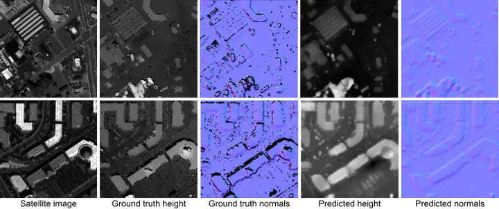
We explore the problem of predicting height maps for man- made and natural terrain when seen from a single image captured by a satellite. This is a very challenging, ill-posed problem, and single-view depth prediction models trained for indoor and outdoor scenes do not immediately apply to the satellite domain. This paper explores this problem for flat and sloped terrain. We propose a baseline model using a deep network that regresses directly from the input image to a height map and is trained using a MAE loss designed specif- ically for our domain. Predicting the height for images with sloped terrain proves to be a particularly hard challenge. To solve for slopes, we train a separate network to predict dense surface normal maps and combine the surface nor- mals and the predicted height in a global optimization step to improve results on sloped terrain. However, the standard optimization strategy using a constant weight for all pixels in an image introduces a regression on the performance on flat terrain. We propose a novel weight prediction model that predicts per-pixel weights as input for the optimization step. We show that this proposed solution improves height prediction for sloped terrain without regressing on the flat terrain and perform evaluations on a range of loss functions, data sets, fusion strategies and training strategies.